


Appleton VFD, Escambia County, Alabama
About
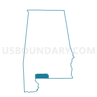
Outline

Summary
| Unique Area Identifier | 521734 |
| Name | Appleton VFD |
| County | Escambia County |
| State | Alabama |
| Area (square miles) | 40.06 |
| Land Area (square miles) | 40.00 |
| Water Area (square miles) | 0.05 |
| % of Land Area | 99.87 |
| % of Water Area | 0.13 |
| Latitude of the Internal Point | 31.21606700 |
| Longtitude of the Internal Point | -87.13053260 |
Maps


Graphs
Select a template below for downloading or customizing gragh for Appleton VFD, Escambia County, Alabama


Neighbors
Neighoring Voting District (by Name) Neighboring Voting District on the Map
- Brewton- Community Center, Escambia County, AL
- Castleberry Fire Dept. -1, Conecuh County, AL
- McCall School, Escambia County, AL
- Sandcutt Fire Dept., Conecuh County, AL
- Wallace -Methodist Church, Escambia County, AL
Top 10 Neighboring County Subdivision (by Population) Neighboring County Subdivision on the Map
- Brewton CCD, Escambia County, AL (10,616)
- Castleberry CCD, Conecuh County, AL (3,251)
- Repton CCD, Conecuh County, AL (1,731)
Top 10 Neighboring Unified School District (by Population) Neighboring Unified School District on the Map
Top 10 Neighboring State Legislative District Lower Chamber (by Population) Neighboring State Legislative District Lower Chamber on the Map
- State House District 92, AL (40,506)
- State House District 66, AL (40,491)
- State House District 64, AL (40,427)
Top 10 Neighboring State Legislative District Upper Chamber (by Population) Neighboring State Legislative District Upper Chamber on the Map
Top 10 Neighboring 111th Congressional District (by Population) Neighboring 111th Congressional District on the Map
Top 10 Neighboring Census Tract (by Population) Neighboring Census Tract on the Map
- Census Tract 9701, Escambia County, AL (4,516)
- Census Tract 9699, Escambia County, AL (4,361)
- Census Tract 9604, Conecuh County, AL (3,251)
- Census Tract 9603, Conecuh County, AL (1,731)